As of October 2023, PLC holds interests in 135 properties totaling approximately 9,470 acres of land. Of this total, PLC owns and manages 28 preserves totaling just over 2,194 acres. All of our lands are open to the public for non-motorized, low-impact recreation. Some properties may have special-use restrictions to protect important natural resources, so please adhere to any posted guidelines. If you have questions about what is or isn’t allowed on one of our preserves, please call us!
PLC also holds conservation easements on 101 properties totaling just over 6,825 acres. Most are privately owned, and a few are owned by municipalities. The easements ensure the permanent protection of the land, but decisions regarding public access and use are generally left to the landowner. Visitors should obtain permission from the landowner in advance, unless noted with the hiker symbol shown below. Again, when in doubt about whether a property is open for recreation, call the landowner or call us!
Trails & Maps
If you are looking for places to hike and explore, visit PLC's Recommended Trails webpage for a list of trails that are open to the public with well-marked trails and maps.
__________________________________________________________
PLC Properties
(Property numbers referenced on map)
![]() Symbol indicates a conservation property is open to the public & has a trail map.
Symbol indicates a conservation property is open to the public & has a trail map.
Brookline
This 88.32 acre easement is located on Oak Hill, Bohanon Bridge, and Pepperell Roads in Brookline, NH and is also known as the Potanipo Rail Trail.
The property is owned by the Town of Brookline, subject to a conservation easement held by PLC.
Key Features:
Extensive floodplain forest and marsh, Nissitissitt River frontage; farm pastureland; fishing, walking trail.
Directions:
From Hwy 13: left onto S. Main St., 0.2 mi. to 1st right onto Oak Hill Rd., then 0.5 mi. to intersection with Bohanon Bridge Rd. Property begins on east side of Bohanon Bridge Rd.
Parking:
At ball field on south side of Oak Hill Rd. across from property and Bohanon Bridge Rd.
Map:
Click here for more information and a trail map.
This 438.5 acre easement is located on Pepperell and Rocky Pond Roads in Brookline, NH.
The property is owned by the Town of Brookline, subject to a conservation easement held by PLC.
Key Features:
Extensive walking trail and woodlands. As well as wetlands and streams.
Directions:
From Hwy 13: Take Meetinghouse Hill Rd. for .4 miles and the take a slight right onto NH-130E for 1.2 miles.
Parking:
Along Pepperell Road at the Cider Mill Pond Trailhead.
Map:
Click here for more information and a trail map.
Bedford & Goffstown
This 346 acre property is located on Joppa Hill Rd. along the boundary of Bedford and Goffstown, NH.
Key Features:
Trails, beaver ponds, mature forest, Mountain Laurel.
Directions:
From Back Mountain Rd. in Goffstown, turn south onto Joppa Hill Rd. Main entrance is 0.4 mi. on the right.
Parking:
Along the roadside
Map:
Click here for more information and a trail map.
Bedford
 
Description:
This 6.2 acre parcel is located on Bell Hill Road in Bedford, NH.
The property is owned by the Town of Bedford, subject to a conservation easement held by PLC.
Key Features:
Walkways, a skating pond, park benches and a bandstand
Directions:
From Bedford Center Road take a right onto Bell Hill Road. Bedford Village Common will be on the left.
Parking:
Off Bell Hill Road
 
Description:
This 28 acre parcel is located on Wallace Road in Bedford, NH.
The property is owned by the Town of Bedford, subject to a conservation easement held by PLC.
Key Features:
Trail, field, sledding
Directions:
From Bedford Center Road take a right onto Church Road and then right onto Wallace Road. Benedictine Park will be on the right.
Parking:
Off Wallace Road at Benedictine Park
Map:
Click here for more information and a trail map.
 
Description:
This 14.7 acre parcel is located in Bedford, NH.
The property is privately owned, subject to a conservation easement held by PLC.
Key Features:
Seasonal pond, woodland
 
Description:
This 190 acre parcel is located on Joppa Hill Road in Bedford, NH.
The property is owned by the Town of Bedford, subject to a conservation easement held by PLC.
Key Features:
Active educational farm, hiking trails, fields
Directions:
From Bedford Center Road head west toward Ministrerial Road. Merge onto North Amherst Road. Continue for 3.4 miles and then turn right onto Joppa Hill Road. The property will be on the left and right of Joppa Hill Rd.
Parking:
Off Joppa Hill Road at the Educational Farm.
Map:
Click here for more information and a trail map.
 
Description:
This 10 acre parcel is located in Bedford, NH.
The property is owned by the Town of Bedford, subject to a conservation easement held by PLC.
Key Features:
Railroad tracks, river frontage
 
Description:
This .23 acre parcel provides Wallace Road access to the Van Loan Preserve and is located in Bedford, NH.
The property is owned by the PLC.
Key Features:
Hiking trails, field
Directions:
From Bedford Center Road take a right onto Church Road and then right onto Wallace Road. The MacDermott Parcel will be on the left.
Parking:
Off Wallace Road at Benedictine Park
Map:
The MacDermott parcel is adjacent to the Van Loan Preserve. For walking, use the Van Loan Preserve trails.
Click here for more information and a trail map of the Van Loan Preserve.
 
Description:
This 2.68 acre parcel is located on North Amherst Road in Bedford, NH.
The property is owned by the PLC.
Key Features:
Historical Bedford Town Pound
Directions:
From Bedford Center Road take merge on North Amherst Road. Continue for .4 miles. The Middleton lot is at the interaction of North Amherst Road and Wallace Road.
Parking:
Off North Amherst Road
 
Description:
This 3.2 acre parcel is located in Bedford, NH.
The property is privately owned, subject to a conservation easement held by PLC.
Key Features:
Woodlands, fresh water marsh
 
Description:
This 6.6 acre parcel is located in Bedford, NH.
The property is privately owned, subject to a conservation easement held by PLC.
Key Features:
Woodlands
 
Description:
This 338 acre parcel is located on New Boston Road in Bedford, NH.
The property is owned by the Town of Bedford, subject to a conservation easement held by PLC.
Key Features:
Hiking trails, gorge, ledge, waterfalls, old mill, forest land
Directions:
From Bedford Center Road take turn right onto Ministerial Road. Continue for 1.3 miles. Then take a right onto Wallace Road. After .8 miles take a left onto New Boston Road. In 3.7 miles Pulpit Rock will be on your left.
Parking:
1. Kennard Trailhead: On the south side of New Boston Road, about .2 mile west of Esther Drive, at approx. 596 New Boston Road
2. Gage's Mill Trailhead: Turn onto Pulpit Road from New Boston Road and drive .72 miles, on the right just after 144 Pulpit Road
Map:
Click here for more information and a trail map.
 
Description:
This 11.4 acre parcel is located on Nashua Road and County in Bedford, NH.
The property is owned by the Bedford School District, subject to a conservation easement held by PLC.
Key Features:
Hiking trails and wetlands
Directions:
From Bedford Center Road continue onto Meetinghouse Road. Take a right onto NH-101 W for .5 miles and then take a left onto Nashua Road.
Parking:
Off North Amherst Road
 
Description:
This 7.6 acre parcel is located on County Road in Bedford, NH.
The property is owned by the Bedford School District, subject to a conservation easement held by PLC.
Key Features:
Hiking trails and wetlands
Directions:
From Bedford Center Road continue onto Meetinghouse Road. Take a left onto Liberty Hill Rd in .8 mile take a left on County Road.
Parking:
Behind the SAU building at 103 County Road
 
Description:
This 23.4 acre parcel is located on Sebbins Pond Drive in Bedford, NH.
The property is owned by the Town of Bedford, subject to a conservation easement held by PLC.
Key Features:
Wetlands, pond, forestland
Directions:
From Bedford Center Road continue onto Meetinghouse Road. At the traffic circle take the 2nd exit and stay on Meetinghouse Road. Turn right onto Patten Road and after .5 take a slight left onto Country Rd. In .5 a mile turn right onto Sebbins Pond Drive and the property will be on your right.
Parking:
There is on-street parking on Sebbins Pond Drive, near the intersection of Heather Drive.
 
Description:
This 68 acre parcel is located on Wallace Road and North Amherst Road in Bedford, NH.
The property is owned by the Town of Bedford, subject to a conservation easement held by PLC.
Key Features:
Wetlands, an old dam, forestland
Directions:
Trailhead 1: 340 Wallace Road Bedford, NH (access directly across from Benedictine Park entrance)
Trailhead 2: 87 North Amherst Road Bedford, NH (parking diagonally across the road, at Muller Park entrance)
Parking:
There is off-street parking for trailhead 1 at Benedictine Park; for trailhead 2, use the off-street parking area for Muller Park.
Map:
Click here for more information and a trail map.
Deering
This 59 acre parcel is located on Pleasant Pond Road in Deering, NH.
Key Features:
Open forest and marshlands; marsh observation. An informal trail loops through the property.
Directions:
From Deering center: RT 149S , Right onto Pleasant Pond Rd, Left onto Old Francestown Rd, property on left.
Parking:
Along Road
This 46.6 acre parcel is located in Deering, NH.
Key Features:
Forestland, beaver ponds, wetlands
This 14 acre parcel is located in Deering, NH.
Key Features:
Forestland, fields, wetlands, impressive stone walls
This 23 acre parcel is located in Deering, NH.
Key Features:
Frontage on Deering Reservoir
This 16.86 acre parcel is located in Deering, NH.
Key Features:
Forestland, fields, wetlands
This 6.6 acre parcel is located in Deering, NH
Key Features:
Island in Deering Lake, please do not access island without prior landowner permission.
This 76.5 acre parcel is located in Deering, NH
Key Features:
Wetlands, forest
Dunbarton
This 13 acre parcel is located in Dunbarton, NH.
Key Features:
Forestland, fields
This 122 acre parcel is located on Everett Dam Road in Dunbarton, NH.
Key Features:
Forestland, wetlands. An expansive trail network covers this property and the adjacent town owned land providing 4-season access.
Directions:
From Dunbarton Center: RT 13S, Right onto Mansion Rd, Left onto Evertt Dam Rd, property on left
Parking:
Along Road
Francestown
This 7.5 acre property is located between 2nd NH Turnpike and Clarkville Rd., at the confluence of Brennan Brook and South Branch Piscataquog River.
Key Features:
Over 1,000 ft. of frontage on the South Branch Piscataquog River and overlooks associated wetlands, with approximately 1 acre of floodplain forest.
Directions:
This property is established primarily as a long-term ecological research site, hence public access is discouraged. There are no trails on, or parking area for, this small tract.
This 149.5 acre parcel is located on Bullard Hill Road, Francestown, NH
Key Features:
Old mill pond and dam, cellar holes, woods road and a natural waterfall
Directions:
From New Boston turn right onto NH Hwy 136 towards Francestown. Travel ~7.5 miles on NH Hwy 136 to the village center in Francestown and the intersection with NH Hwy 47; Turn right onto NH Hwy 47 and continue northwest for ~1.3 miles to Campbell Hill Road; turn left onto Campbell Hill Road and travel ~0.3 miles to Class VI (unmaintained) Bullard Hill Road. Turn left onto Bullard Hill Road (and stay right at the road fork), going ~0.25 miles to the property’s parking area (presently a log loading deck), on the left.
Parking:
A parking area (presently a log loading deck) is ~0.25 mile on Bullard Hill Road on the left side of the road (see the directions above).
This 26.6 acre parcel is located in Francestown, NH.
Key Features:
Forestlands, Wetlands
This 16 acre parcel is located in Francestown, NH.
Key Features:
River frontage on South Branch Piscataquog River
This 15 acre parcel is located in Francestown, NH.
Key Features:
River frontage on South Branch Piscataquog River
This 101 acre parcel is located on Russell Station Road in Francestown, NH.
Key Features:
Forest & wetlands
Directions:
From the 2nd NH Turnpike in Francestown, drive west on Russell Station Road for 2.9 miles. From the parking area, walk about 1.2 miles south up French Hill Road until you get to an intersection with an old woods road on your right with a little wooded island in the middle of the intersection. Here, you walk half a mile up this old woods road (passing a“No Motorized Vehicle” sign) to the property’s east boundary. This boundary is marked with PLC signs and “No Motorized Vehicle” signs. From here you can walk throughout the rest of the property.
Parking:
After bridge, park immediately on the right side of road.
This 18.7 acre parcel is located in Francestown, NH.
Key Features:
Forest & wetlands
Directions:
From Francestown center: South onto 2nd NH Turnpike for about 2.6 miles. Property on right
Parking:
Along Road
Francestown & Lyndeborough
This 77 acre parcel is located on Russell Station & French Roads
Key Features:
Forestland, extensive stone walls
Directions:
From the 2nd NH Turnpike in Francestown, drive west on Russell Station Road for 2.9 miles. The property will be on your left, near French Rd.
Along Road
This 41-acre property is located on Russell Station Road (a class V road) and Woodward Hill Road (a class V road) in Francestown, NH.
Key Features:
The property contains 1,000 feet of frontage along the South Branch of the Piscataquog River and 1,700 feet of frontage along Rand Brook. The property contains a 14.7-acre wetland complex that overlaps with approximately 24.1 acres of red maple floodplain forest (S2S3). The property’s forests consist primarily of hemlock-hardwood-pine and a small amount of Appalachian oak-pine. The property gently slopes from 600 feet along the Piscataquog River in the eastern portion of the property up to 680 feet in the western portion of the property.
This 15.82 acre parcel is located on South New Boston Rd, Francestown & High Bridge Road, Lyndeborough, NH
Key Features:
River front
Goffstown
This 129.3 acre parcel is located on Blackbriar Road in Goffstown, NH.
Key Features:
Forestland, wetlands
Directions:
Montelona Rd. 0.7 mi. west of Tirrell Hill Rd., south on Shanty (GPS @ 197 Montelona Rd.) 0.2 mi; parking area on left. (Please Note: Access to Blackbriar is through PLC's adjacent property Black Brook Preserve.)
Parking:
Parking area on Shanty Road.
Map:
Click here for more information and a trail map.
This 101 acre parcel is located on Shanty Road in Goffstown NH.
Key Features:
Beaver pond, Black Brook, Prime Wetlands, vernal pools and other wetlands
Directions:
Montelona Rd. 0.7 mi. west of Tirrell Hill Rd., south on Shanty (GPS @ 197 Montelona Rd.) 0.2 mi; parking area on left.
Parking:
Parking area on Shanty Road.
Map:
Click here for more information and a trail map.
This 86 acre parcel is located at 78 Locust Hill Road in Goffstown, NH
Key Features:
Forestland, wetlands
Directions:
From Goffstown center: Right onto Elm St for 1.1 miles. Left onto Paige Hill Rd for 0.7 miles, Right onto Locust Hill Rd. Property on left.
Parking:
Along road near power lines
This 59 acre parcel is located on Montelona Road in Goffstown, NH.
Key Features:
Purgatory Brook flows through the eastern portion of the property, joined by an unnamed tributary from the northwest
This 15 acre parcel is located at the Intersection of Parker Road and RT 114
Key Features:
Frontage along North Branch Piscataquog River
Directions:
From Goffstown center: RT 114N for 1.7 miles, left onto Parker Rd
Parking:
Park on right side of Parker Rd.
This 147 acre parcel is located in Goffstown, NH.
Key Features:
Forest land, fields, beaver pond
This 40.98 acre parcel is located in Goffstown, NH.
Key Features:
Farmland, forest land and wetlands
This 19.15 acre parcel is located along Montelona Road in Goffstown, NH, across from Blackbriar Woods.
Key Features:
Forestland
This 32 acre parcel is located on Henry Bridge Rd in Goffstown, NH.
Key Features:
Flood plain forest, river frontage on Henry Brook and the Piscataquog River.
This 14.3 acre parcel is located in Goffstown, NH.
Key Features:
Fields, vistas
This 77.3 acre parcel is located in Goffstown, NH.
Key Features:
Forestland
This 13.4 acre parcel is located in Goffstown, NH.
Key Features:
Forestland, fields
This 65.1 acre parcel is located in Goffstown, NH.
Key Features:
Forestland, fields, vistas
This 22.1 acre parcel is located in Goffstown, NH.
Key Features:
Forestland, fields, vistas
Greenfield
This 10 acre parcel is landlocked.
Key Features:
Forestland, vistas
Directions:
From the 2nd NH Turnpike in Francestown, drive west on Russell Station Road for 2.9 miles. From the parking area, walk about 1.2 miles south up French Hill Road until you get to an intersection with an old woods road on your right with a little wooded island in the middle of the intersection. Here, you walk half a mile down this road (passing an old “No Motorized Vehicle” sign) to the property’s east boundary. This boundary is marked with PLC signs and “No Motorized Vehicle” signs. From here you can walk throughout the rest of the property.
Parking:
Park on the left side of the road where French Hill Road (a class VI road) intersects.
This 22.8 acre parcel is located in Greenfield, NH
Key Features:
Forest, wetlands
Henniker
This 113.5 acre parcel is located on Colby Hill Road in Henniker, NH
Key Features:
Forestlands, vista; glacier eratica, seasonal stream
Directions:
From Henniker center: RT 114N, Left onto Davidson Rd, Right onto Liberty Hill Rd to Colby Hill Rd. on left. Colby Hill Road is a Class 6 road - not maintained. You can drive a little way on Colby Hill Rd., but use caution. Park along the side of the road and continue on foot to the Property on your left.
Parking:
Along Road
This 13.196 acre parcel is located in Henniker, NH
Key Features:
Frontage on Craney Pond, wetlands, peatland. Generally open to the public, may close on occasion due to trail conditions.
This 277.1 acre parcel is located on Freeman Colby Road in Henniker, NH
Key Features:
Forestland
Parking:
A parking area has been established past the house on the left opposite a driveway / road on the right
This 55.41 acre parcel is located on Craney Pond Road in Henniker, NH.
The property is owned by the Town of Henniker, subject to a conservation easement held by PLC.
Key Features:
Hemlock/hardwood/pine forest with a north-south ridgeline separating the Contoocook watershed to the west and the Piscataquog watershed to the east. The forest has Black Gum vernal pools.
Directions:
0.9 mi. on Flanders Rd. from Hwy 114 (~2 mi. south of Contoocook River bridge in Henniker), left on Craney Hill Rd.; 2.3 mi. on Craney Hill Rd., then left on Bowers Rd. (Class VI) for 0.2 mi., then left on Craney Pond Rd. for approximately 0.3 mi. to start of property on the right.
Property Access: Access anywhere along the boundary from Class VI Craney Pond Rd.
Lyndeborough
This 15.375 acre parcel is located along Lyndeborough Rd., between 2nd NH turnpike (aka Francestown Turnpike) and Salisbury Rd. in Lyndeborough, NH
Key Features:
Forest, floodplain, steep drumlins. Frontage on 'Scataquog & Cold Brooks, waterfalls, well-maintained trail with guide available at trailhead.
Directions:
From Francestown (2nd NH) Turnpike take Lyndeborough Road west about 0.4 mi. to trailhead on the right.
Parking:
Along Road
Map:
Click here for more information and a trail map.
This 111.37 acre property is located on two tracts: 70+ ac. on Mountain Rd. (Cold Brook) abutting PLC Grossman, and 40+ ac. on Lyndeborough Rd. (Scataquog Brook) abutting the Alan & Edgar Rice Preserve.
Key Features:
Eskers, Scataquog Brook with native trout, Cold Brook and forested slopes.
Directions & Parking:
Scataquog Brook Tract– 0.4 mi. on Class VI Lyndeborough Rd. west from 2nd NH Turnpike to the Rice Preserve, accessing the Proctor lot to the south. Additionally, access can be had another 0.2 mi. further along Lyndeborough Rd., with a cart path into the tract’s southern portion.
Cold Brook Tract – from Lyndeborough Rd. head north on 2nd NH Turnpike ~ 0.8 mi., turn left onto New Rd., then right on Mountain Rd. Approximately 0.6 mi. Class VI Richardson Rd. to the left provides parking and access to the tract.
This 270 acre parcel is located in Lyndeborough, NH
Key Features:
Forest, field, wetland
This 161.9 acre parcel is located on Pettinghill Hill Lyndeborough, NH
Key Features:
Forest, frontage on Burton Pond, informal trail network.
Directions:
From Lyndeborough center: RT 31N, Left onto Pettingill Hill Rd about 1.8 miles. Property on left across from Avalon Rd.
Parking:
Along Road
This 79 acre parcel is located in Lyndeborough, NH
Key Features:
Forest, field, frontage on Stoney Brook
This 34 acre parcel is located in Lyndeborough, NH
Key Features:
This 211 acre property is located on Scout Road in Lyndeborough, NH.
Key Features:
Cellar hole at Rose farm site, Scout Rd.; summit views; spruce on summit & northeast-facing upper slopes; blueberries abound from commercial operations in recent past; wetland/vernal pool on Helens Trail at pinch point of the two property lobes.
Terrain:
Summit 1,720 ft. elevation; steep, heavily eroded trails, particularly Scout Rd. and North Trail
Uses:
Allowable uses include snowmobiles, horses, mountain bikes, and hikers/skiers/snowshoers. Much prohibited use by large ORV/trucks, heavy erosion of summit and North Trails
Directions:
Helen Trail/The Pinnacle (from east) - heading 1.1 mi. south on Mountain Rd. from where Greenfield Road intersects, trail head on west side of road.
Scout Rd./Town Forest Trail (from south) – Pinnacle Rd. from Center Rd., left on Class VI Pinnacle, right on Class VI Scout Rd., trail head at Town Forest, north of wetlands.
Parking:
There is a small parking area on Scout Road, which is an unmaintained class VI road. Due to road erosion, driving to the parking lot can be treacherous. Please use caution. 4WD is required. Parking along Pinnacle Road is an option.
Maps:
Click here for more information and a trail map.
Mason
This 267.05 acre parcel is located on the south side of Abbott Hill Road in Mason, NH.
Key Features:
Extensive forestland, wetlands, and vernal pools.
Directions:
From Hwy 31: Take Isaac Frye Hwy, continue straight onto Gage Rd. then turn right onto Abbott Hill Rd after a mile turn right to stay on Abbott Hill Rd.
Parking:
Along Abbott Hill Rd.
New Boston
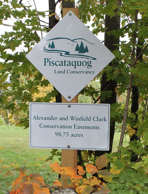
This 98.75 acre parcel is located on Lewis Road in New Boston, NH
Key Features:
Woodland trail, Beaver Pond, "Harry's Trail" trailhead on Lewis Rd.
Directions:
From New Boston center: Up Meetinghouse Hill Rd, Left onto Joe English Rd, Left onto Lewis Rd
Parking:
Parking area at end of Lewis Rd
Map:
View the Clark trail map
This 3.06 acre parcel is located in New Boston, NH
Key Features:
Small, landlocked island in Piscataquog River
This 15 acre parcel is located on Pine Road in New Boston, NH
Key Features:
Woodlands
Directions:
From New Boston Center: Right onto RT 77, Left onto RT 136W for 2.1 miles, Left onto Thornton Rd, Right onto Pine Rd, to end of road
Parking:
Parking area at end of road
This 83.6 acre parcel is located in New Boston, NH
Key Features:
Farm land
This 54.92 acre parcel is located on Dougherty Lane in New Boston, NH
Key Features:
River Front and Woodlands
Directions:
From New Boston center: Right onto RT 77, Left onto RT 136, Right onto Tucker Mill RD, Right onto Dougherty Lane
Parking:
Along Road
This 79.9 acre parcel is located in New Boston, NH
Key Features:
Vast wetlands
This 30.02 acre parcel is located along the Middle Branch of the Piscataquog River in New Boston, NH
Key Features:
River Front and Woodlands
Directions:
From New Boston center: Right onto RT 77, Left onto RT 136, Right onto Tucker Mill Road, Right onto Dougherty Lane. Property can be accessed through PLC's George Thomas Wildlife Sanctuary.
Parking:
Along Road
This 56.852 acre parcel is located on Clark Hill Road in New Boston, NH
Key Features:
Woodlands
Directions:
From New Boston center: Cross RT 13, travel up Clark Hill rd about 1 mile. Property on both sides of road.
Parking:
Along road.
This 3.125 acre parcel is located on 2nd NH Turnpike New Boston, NH
Key Features:
Wetland, spring
Directions:
From New Boston center: RT 13S, Right onto Lyndborough Rd till end, Right onto 2nd NH Turnpike, property on right
Parking:
Side of road
This 24 acre parcel is located on Francestown Road in New Boston, NH
Key Features:
Wetlands
Directions:
From New Boston center: Right onto RT 77, Left onto RT 136W, property on left
Parking:
Along road near sign
This 73 acre parcel is located in New Boston, NH
Key Features:
Mountain View
This 20 acre parcel is located on Pine Road in New Boston, NH
Key Features:
Woodlands, well-marked trail network
Directions:
From New Boston Center: Right onto RT 77, Left onto RT 136W for 2.1 miles, Left onto Thornton Rd, Right onto Pine Rd, to end of road
Parking:
Parking area at end of road
This 36.946 acre parcel is located on Meadow Road in New Boston, NH
Key Features:
Woodlands and wetland trail
Directions:
From New Boston center: Left onto RT 13S for 2.5 miles, right onto Meadow Rd, look for sign
Parking:
Along road
Map:
Local unmarked trails: No trail map is available at this time, but the trails are open to the public.
This 32 acre parcel is located in New Boston / Lyndeborough NH
Key Features:
Woodlands, wetlands
This 28.85 acre parcel is located in New Boston, NH
Key Features:
Woodland, abuts Great Meadow
This 148.24 acre parcel is located on Pine Road in New Boston, NH
Key Features:
Woodlands
Directions: From New Boston Center: Right onto RT 77, Left onto RT 136W for 2.1 miles, Left onto Thornton Rd, Right onto Pine Rd, to end of road
Parking:
Parking area at end of road
This 73.6 acre parcel is located on Saunders Hill Road in New Boston, NH
Key Features:
Woodland, abuts Great Meadow
Directions:
From New Boston Center: Right onto RT 77, Left onto RT 136W , Right onto Tucker Mill Rd, Left onto Saunders Hill Rd
Parking:
Parking lot
Map:
Click here for more information and a trail map.
This 96 acre parcel is located in New Boston, NH
Key Features:
Field, river front, active agricultural use
This 135.3 acre parcel is located on Scobie Rd in New Boston, NH.
Key Features:
Forest, wetlands, beaver pond.
This 16.9 acre parcel is located in New Boston, NH
Key Features:
Wetlands, beaver pond
This 93.3 acre parcel is located in New Boston, NH
Key Features:
Woodland, abuts Great Meadow
This 4 acre parcel is located in New Boston, NH
Key Features:
Woodlands, river front
This 6 acre parcel is located in New Boston, NH
Key Features:
Woodland, wet lands
This 193 acre parcel is located on Tucker Mill Road in New Boston, NH
Key Features:
Woodlands, old foundations
Directions:
From New Boston center: Right onto RT 77, Left onto RT 136W , Right onto Tucker Mill Rd
Parking:
Small parking area in front of sign
Map:
Click here for more information and a trail map.
This 53 acre parcel is located in New Boston, NH
Key Features:
Woodlands, marsh lands
Weare
This 204.86 acre parcel is located on Mountain Road in Weare, NH
Key Features:
Woodlands, vernal pools
Directions:
From Weare center: RT 77/114S, Right onto RT 149 about 1.5 miles, Left onto Perkins Pond Rd for 1.5 miles to 4 corners, Right onto Mountain Road. Parking 1 mile on right.
Parking:
Town of Weare parking lot on right where power lines cross the road.
This 98 acre parcel is located on Flanders Memorial Road in Weare, NH
Key Features:
Woodlands, wetlands, Breed Brook frontage, Open space subdivision (Holly Hills)
Directions:
From Weare center: RT 77/114S, Right onto Flanders Memorial Rd about 1.2 miles, Right onto Holly Hill Farm Rd, Left onto Winterberry Rd.
Parking:
Along Winterberry Rd
This 154 acre parcel is located on River Road in Weare, NH
Key Features:
Woodlands, wetlands
Directions:
From Weare center: RT 77/114S, Right onto Flanders Memorial Rd, Right onto Hodson Rd, Left onto Shady Hill Rd, Right onto Chevey Hill Rd
Parking:
At end of Chevey Hill Road
This 9.3 acre parcel is located on River Road in Weare, NH
Key Features:
Ravine, woodlands, river front
Directions:
From Weare center: RT 77/114S, Left onto East Rd for 1.1 miles, left onto Peaslee Hill Rd, Left onto River Rd.
Parking:
Along Peasley Road near bridge
This 608 acre parcel is located on Pine Hill Road in Weare, NH.
The property is owned by the Town of Weare, subject to a conservation easement held by PLC.
Key Features:
Woodlands, wetlands
Directions:
From Weare center: RT 77/114N, Right onto Center Rd, Right onto RT 77, Left onto Pine Hill Rd
Map:
Local unmarked trails: No trail map is available at this time, but the trails are open to the public.
This 57 acre parcel is located on Ferrin Pond Road in Weare, NH
Key Features:
Shoreline along Ferrin Pond
Directions:
From Weare center: RT 77/114S, Right onto RT 149 about 1.5 miles, Left onto Perkins Pond Rd for 1.5 miles to 4 corners, Right onto Mountain Rd. Parking 1 mile on right.
Parking:
Town of Weare parking lot on right where power lines cross road
Map:
Click here for more information and a trail map.
This 26.3 acre parcel is located in Weare, NH
Key Features:
Woodlands, fields, wetlands, open space subdivision
This 84.21 acre parcel is located in Weare, NH
Key Features:
Woodlands, fields, active agricultural use
This 95.32 acre parcel is located at 21 General Knox Road in Weare, NH
Key Features:
Woodlands, fields, wetlands
Directions:
From Weare center: RT 77/114S, Left onto RT 114, Left onto General Knox Rd
Parking:
Along road
This 40 acre parcel is located in Weare.
Key Features:
Field, woodlands, active agricultural use
This 19.139 acre parcel is located in Weare, NH
Key Features:
Woodlands, Fields, active agricultural use
This 18 acre parcel is located in Weare, NH
Key Features:
Farmland, woodland, beaver pond, active agricultural use.
This 4.02 acre parcel is located in Weare, NH
Key Features:
River front walk
This 35.83 acre parcel is located in Weare, NH
Key Features:
Farmland, forestland, wetlands
This 10 acre parcel is located at 132 Dudly Brook Road in Weare, NH
Key Features:
Woodland trails
Directions:
From Weare center: RT 77/114N for 1.6 miles, Left onto Reservoir Dr, Left onto Dudly Brook Rd, look for sign
Parking:
Along road
This 114 acre parcel is located Weare NH
Key Features:
Fields, woodlands
This 23.48 acre parcel is located on Mountain School Road in Weare, NH
Key Features:
Woodlands and pond
Directions:
From Weare center: RT 77/114S, Right onto RT 149 for .6 miles, Right onto Mountain Rd. for 1.3 miles, Straight onto Mountain School Rd., property on right before Bougue Rd.
Parking:
Along Mountain School Rd
This 78.8 acre parcel is located in Weare, NH
Key Features:
Woodlands, fields, wetlands
This 81.4 acre parcel is located on River Road in Weare, NH
Key Features:
Woodlands, fields, wetlands
Directions:
From Weare center: RT 77/114S, Left onto RT 114, Left onto General Knox Rd
Parking:
Along Road
This 31 acre parcel is located in Weare, NH
Key Features:
Farmland, woodland, beaver pond, active agricultural use
