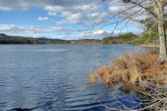
April 2024 – Over the course of 2023, the Piscataquog Land Conservancy developed a new land conservation plan for our 26-town service area. The timing was right for a comprehensive update because PLC’s previous plan from 2014 was nearly a decade old and only covered half of our current region. In addition, new data related to climate resilience and adaptation had become available, while other existing natural resource data sources had been updated and refined.
PLC’s new plan integrates this most-current natural resource and climate related data, selected and weighted to reflect PLC’s overall strategic priorities, and mapped and prioritized for the PLC region using Geographic Information System (GIS) technology. The resulting conservation priority areas identify those specific geographic locations with the highest concentration of natural resource values that provide multiple benefits to both people and wildlife. The plan also includes a network of connecting corridors between the core areas for wildlife (and in some cases human) passage. A map showing the plan’s priorities can be found on the next two pages of this newsletter.
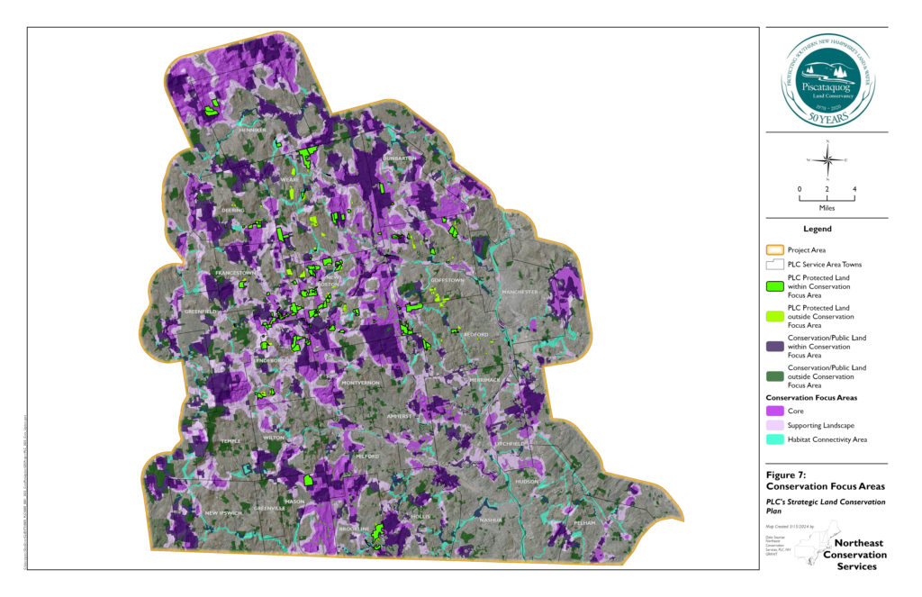
Conservation Priorities
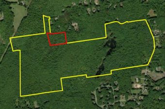
The plan’s GIS data analysis classifies the top twenty percent of the PLC service area, or about 96,000 acres of land, as “Core Focus Area” (dark purple areas on map) and the next twenty percent of the region as “Supporting Landscape” (light purple) areas that buffer and connect the core areas. Before these data-derived areas were finalized, the project consultant reality-checked them against actual conditions and manually removed any overlaps with developed or otherwise degraded areas. Another four percent of the PLC region is identified as habitat “Connectivity Areas” (teal green on map) which were also manually added, using the riparian (stream) network, floodplains, topography, proximity to buildings, and the NH Fish and Game Department’s own analysis of wildlife corridors.
How Have We Done So Far?
As of the plan’s completion at the end of 2023, 73,065 acres or about 34% of all the land identified as a conservation priority (core + supporting + connectivity combined) had already been permanently conserved. Of the 9,410 acres conserved to date by PLC, 7,359 acres or just over 78% are in areas identified as conservation priorities in our new plan. In other words, PLC has been generally acquiring land and conservation easements in the “right” places in recent decades, and there has been much progress overall in conserving the most critical land within our region. That said, the numbers also tell us there is still much left to do.
What’s Next?
PLC’s now-completed land conservation plan will be used to guide every land conservation project we undertake over the next decade. It will also help focus our proactive outreach to landowners. It should be stressed that the plan is intended only as a guide for voluntary land transactions, and not for any type of regulation. Looking ahead, PLC will meet with Conservation Commissions in our service area towns through the rest of 2024 to explain the plan’s methodology and findings, and how towns can use it in their own land conservation efforts. An interactive map and detailed technical report on how the plan was developed will both be made available on the PLC website.
PLC’s land conservation plan was developed through a collaboration of PLC board and committee members, staff and consultant Peter Steckler of Northeast Conservation Services. The project was funded in part by the Land and Climate Grant Program, a joint initiative of Open Space Institute and Land Trust Alliance made possible with funding from the Doris Duke Charitable Foundation, Jane’s Trust Foundation, the J.M. Kaplan Fund, the Volgenau Foundation, and the William Penn Foundation.